The next in our series of articles following our success at the #GEAwards takes a look at Digital Geological Modelling.
At CampbellReith we are expanding and developing our digital capabilities to support our design solutions across a range of projects. One such technique is the use of digital geological models, which are a useful tool to understand and visualise a site in three dimensions.
A digital geological model can support the interpretation and assessment of the geotechnical conditions at a site and to develop the understanding of these conditions with the structural elements of the project or associated assets.
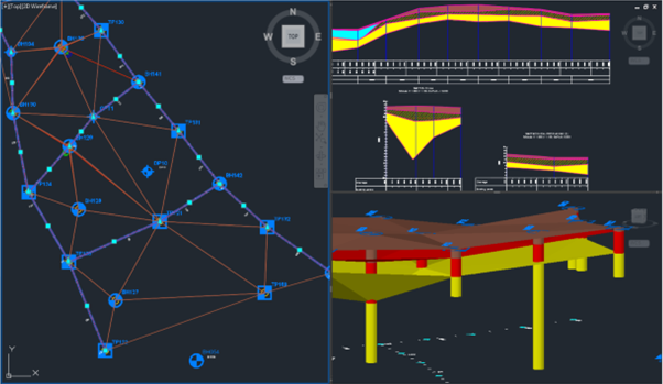
Using AGS data obtained from ground investigation and lab analysis we use AutoCAD Civils 3D with the Hole Base SI Extension to rapidly build and refine geological models directly from site data. AGS data can be imported straight into the model allowing modifications to be undertaken as the data becomes available.
Examples of field data include recorded zones of core loss, and disturbed, fractured or voided ground for the assessment of historic mining areas or sites susceptible to subsidence. Lab and field test data such as SPTs, triaxial and permeability data can be viewed in 3D to identify variations in soil behaviour spatially and with depth across the site.
As well as extrapolating strata boundaries, groundwater observations can be included to understand the hydrogeological regime at a site. Engineering properties can be incorporated into the model with structural information in a way that allows them to be understood in the context of the proposed development. In other scenarios, the digital model can be used to assign volumes to different geological units for mineral exploitation or to determine cut and fill volumes.
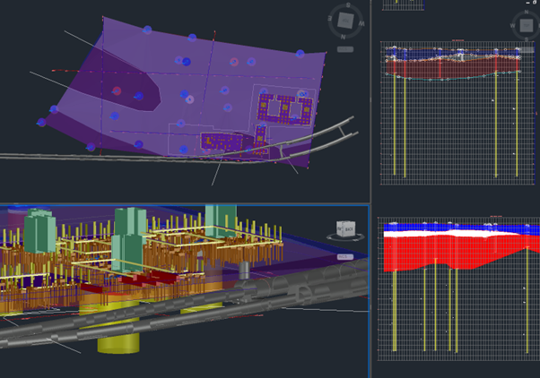
The ability to process this data allows sensitivity checks to be quickly undertaken, providing confidence in the modelling. When the analysis is complete, the visualisations that are obtained are highly useful in communicating ideas or themes to stakeholders, whether it be through images, videos or live run throughs of the models, or outputs for further software analysis. Used properly, this thorough understanding of the ground can be key to designing efficient and sustainable solutions and reducing risk for our clients.